

Climbing
Climbing Around Lander
Climbing
Climbing Around Lander
Lander is famous for its climbing. The well-known rock climbing areas, Wild Iris and Sinks Canyon, are renown by climbers all over the world. While sport climbs reign king nearest to town, there are many world class trad climbs and alpine climbs within a short drive and hike. New sport climbs are established each year, and along with all of the alpine climbs in the Wind River Mountains, it is easy to see that there is an entire lifetime of climbing. If you are looking for personal advice ask one of our employees who will gladly recommend climbing areas, favorite climbs, or classic must-do climbs in the area.
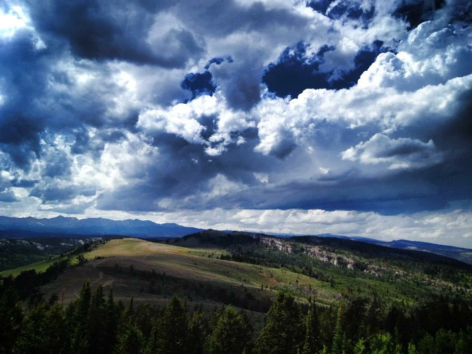
Wild Iris
Wild Iris
Wild Iris
Wild Iris
Camping Information
@Atlantic City/ South Pass campgrounds
A few miles west of Limestone Mountain Road, there are a couple of campgrounds managed by the Bureau of Land Management. (BLM 307-332-8400)
@Wild Iris Crag
Free camping along the two track road that parallels the base of the OK Corral wall is very popular during the summer. Please pack out what you pack in. Use the vault toilet located at the beginning of the two track road that accesses the camping. Be aware of any fire bans in effect and honor them. There is no water at this area, so bring plenty with you.
BE DISCREET and low impact! Hang your food! This is bear country. Don't leave food outside of your vehicle unless you are there with the food and consuming. Same applies for dog food. Also do not leave food in your tent during the day or at night. Bears like all food, especially human food! Shoshone National Forest (307) 332-5460.
From Lander, drive beyond Limestone Mtn. Rd (road to Wild Iris Climbing Area) about 5 miles. Look for the brown sign on your right; the turn is on your left. The fee here is $6 per night. Picnic tables, water, and pit toilets. Water is turned off. Price reduced for seniors ($3 with Golden Age Pass).
Sinks Canyon and Fossil Hill
Sinks Canyon and Fossil Hill
Sinks Canyon is the local crag, more so than any other climbing area around.
Sinks Canyon and Fossil Hill
Sinks Canyon and Fossil Hill
Sinks Canyon is the local crag, more so than any other climbing area around.
Sinks Canyon is one of the best limestone sport climbing crags in the country. The rock quality is generally excellent, and you can find everything from hand swallowing pockets in the Killer cave to perfect overhanging crimps on the Addiction Wall. There is climbing for every ability here from 5.6-5.14c. While there are gems of every grade, the most classic climbs are 5.10 and up. Sink's is the closest climbing area from town, it is about a 10 minute drive to the Main Wall parking lot, and about a 15 minute approach. You can climb at Sinks all year, but the best climbing temperatures are during the cooler months.
Fossil Hill is about 1000’ higher than Sinks and is slightly more west facing. The routes are longer than than Wild Iris and feature more pockets than Sinks. The rock quality is quite good and the grades range from 5.8 to 5.14c. It is best in the fall and late summer evenings, but it can get hot in the middle of the day.
SINKS CANYON CAMPING
(Four developed options all on south/left side of the road as you drive west/up canyon):
Sawmill Campground Sinks Canyon State Park at the mouth of the canyon and State Park entrance, across road from the Sandstone Buttress. See State Park Website for most up to date information.
Popo Agie Campground Sinks Canyon State Park is located on the western edge of the State Park. Climbing at any of the shady side walls can be approached right from your campsite. Please visit Sinks Canyon State Park website for most current information.
SHOSHONE NATIONAL FOREST WASHAKIE RANGER DISTRICT CAMPGROUND: Sinks Canyon Campground has 14 campsites. It is located west of Sinks Canyon State Park just a few hundred yards into the forest. There is a nearby rock climbing area on BLM lands. Amenities include one vault toilet, picnic tables, cook grates, and potable water.
Hugh Otte Free Dispersed camping area just past the Missouri Field Camp. Walking distance to "the Wilds" or Fairfield Hill. Limited sites, 1 pit toilet and no tables or fire pits. Please keep the area clean. Do not drive off road in wet or dry conditions!
Wind River Mountains
The Wind River Range
Wind River Mountains
The Wind River Range
The granite peaks of the Wind River Mountains provide both multi-pitch technical climbing and hike-up ascents. The Cirque of the Towers draws hundreds of climbers a year, though the Winds are full of hundreds of other unheralded, incredible climbs as well. The summit of Gannett Peak, Wyoming's highest point (13,804 ft.) is accessible via a technical trek after a 23-mile backpacking approach. Since the Wind River Mountains are a National Wilderness Area, there are no roads leading in. You must hike to your destination from one of the many trailheads that border the range.
Cirque of the Towers The Cirque of the Towers is the most climbed and most photographed area of the Wind River Mountains. For good reason: the jagged peaks are stunning.
Two of the "Fifty Classic Climbs" as designated by Steck and Roper are jewels of the Cirque: the northeast face of Pingora (IV, 5.9) and the east ridge of Wolf's head (III, 5.6). The other spires here (Overhanging Tower, Shark's Nose, War Bonnet, Mitchell Peak, Monolith Peak, Lizard Head...) offer more incredible routes than can be climbed in one trip.
To get to the Cirque, start at the Big Sandy Entrance in the south. The trail to Big Sandy Lake is approximately 6 miles, with an elevation gain of only 500 ft. From Big Sandy Lake, head up over the aptly named Jackass pass. The total approach is 9 miles. The summer climbing season for the Cirque of the Towers is short, lasting only from about mid-June to Mid-September.
Gannett Peak Gannett Peak, in the Northern Winds, is Wyoming's tallest mountain (13,804 ft). It is a beautiful alpine summit surrounded by jagged granite mountains, glaciers, and high plateaus.
Please note that a Gannett Peak summit attempt should be taken seriously. Glaciers on the mountain are pocked with deep crevasses that in early spring can lay hidden under a coat of shallow snow. Ropes, crampons, ice axes and alpine-climbing savvy are essential.
The most popular trail leading to Gannett Peak is the Glacier Trail, which starts outside of the town of Dubois off of HWY 20-26. From here, the approach is 23 miles over rather strenuous terrain. This is the main trail into the northern Winds, and is very popular in the summer months.
The Ink Wells Trail is the shortest approach to Gannett Peak, approximately 14 miles. However, its usage is governed by the Wind River Indian Reservation. A guide and a permit are required to access the trailhead. If you wish to use this trailhead, you must contact the Wind River Tribal Game and Fish Department at 307-332-7207.